Showing posts with label geology. Show all posts

Wednesday, March 10, 2021

Back to Adventures - The Sinking Temple

We once again return to the scattered small adventures culled from some Jackson maps. This map was included in "A Collection of Presentations Cartographical in Nature," a selection of five maps Matt had produced for his Patreon, back in the day.


Again, this one had a good space to work with, and had to have an interesting story behind it. After all, how does a temple with a three-story tower "sink" into the ground? I chose to sink it, instead, by inundating it with a lahar.  

Source

Never mind that a building hit by a fast-flowing concrete-like slurry would have likely been collapsed. We're in fantasy-land. We need a buried building that's been knocked off-kilter. I can let geology slide now and then... 

In this case, a lahar happens when you neglect to ask the god of the temple if they mind that you are changing patrons (Spoiler, they do mind). You get thwacked by a mudflow, and the god leaves in a huff

And, as happens, other things move into the abandoned space, and they bring their pets with them.

Probably not a spoiler

So, enjoy your explorations of The Sinking Temple. As always, watch your step.

Tuesday, April 10, 2018

D&D vs Geology

I've occasionally opined on the geologic environs with respect to D&D, so, yeah, this is pretty much truth....
https://twitter.com/_sashawilson_

Friday, March 10, 2017

RPG Blog Carnival: Things in the Dark

Moebius Adventures opened up their figurative doors to host this month's RPG Blog Carnival, with the topic of 'Things in the Dark'...


...whether they are critters, environments, or just making one's way around in the dark places that PCs have a bad habit of exploring.

So, I will, as I often do, grab a bit of real history and bend it a bit for a little gaming goodness...

Mining.  Deep underground, dirty work in the darkness.  Personal illumination to safely and effectively work was important (well, effectively, safely came later...)

Trouble is, mines and other similar confined spaces can have a problem of atmosphere - Not enough oxygen, too much oxygen, explosive dusts or gasses, or poisonous atmospheres.  These so-called 'damps' (from the German dampf, or vapor) were a constant hazard.

And open flames can exacerbate those problems - especially in the cases of explosive environments or oxygen-enriched environments (where combustion can accelerate or spread rapidly).  Since miners often relied on open flames, such as helmet-mounted oil lamps (below), there was an incentive to find a less dangerous alternative, or at least methods to assess an atmosphere before working in an area (the fabled canary could only do so much, after all...).

Source

Thursday, October 6, 2016

Salt Dwarves (and salt golems)

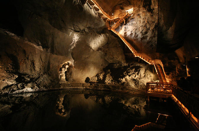
The Salt Dwarves, in contrast with their mountain kin, mine the subterranean salt domes and evaporite basins eschewing their brethren's search for gems and precious ores, instead excavating the "buried ocean."  These mines extend deep into the ground, tapping the halides left by ancient seas and buried under eons of deposits.
source

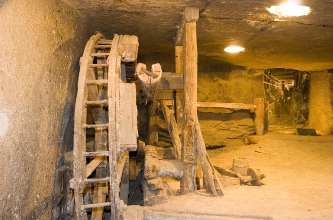
Like their hard rock mining cousins, the Salt Dwarves hollow huge caverns beneath the earth, for the mines are both their vocation and homes.  The mines are supported by elaborate timber and rope shoring and cribworks, proof against the slowly settling and flowing salt.  Massive water wheels and pumps evacuate the caverns of brackish water.

source
source
Source
Periodically, the dwarves, with their salt-encrusted beards and cracked hands, will come to the surface of their mines, hauling their troves of salt to the surface. Salt dwarves, when encountered, tend to be kitted out in leather armor, with a thick, padded skullcap, and wielding a mining or war-pick. They wear no metallic armor due to the corrosive tendencies of the saline atmosphere within the mines.


Saturday, September 5, 2015

Monster: Eurypterid, Feersum


The recent discovery of a new species of 'sea scorpion,' or eurypterid, pushes evolution of the the Paleozoic predator back approximately 10 million years.  The new genus was named Pentecopterus, after the penteconter, an early Greek galley. Although these particular fossil individuals were approximately six feet in length, specimens of over eight feet long have been found.

The eurypterid was not a scorpion, but an arthropod more closely related to modern spiders, lobsters, and ticks.  The 'sea scorpion' nomenclature come from the spiked tail in some genus', however they have not been found to be venomous, and likely preyed on trilobites and other creatures using modified forelegs and claws.
Source

Sunday, May 17, 2015

UW Astronomer's logbook, May 18, 1980

On the 35th anniversary of the day an earthquake rocked Mt. St. Helens, triggering the eruption that released nearly a cubic mile of rock and ash into the atmosphere, may I present to you the daily log of the University of Washington's Manastash Ridge Observatory.

Source

It's the end of the world, and the radio stations are still playing 'cha-cha' music...

Thursday, May 7, 2015

THE FLOOR IS LAVA!!!

Joe Wetzel's second geomorph contest theme was lava.

Well, I completely lost track of time until I looked at the contest page and realized that I had about three hours to draw up my entries. At 10 PM local time.  So they are really low quality. Yes.  Even lower-quality than my usual pieces..

So, two entries, in under the wire.  Lava.  And because basalt often forms hexagonal columns as it cools, the floors of the two geomorphs are hexes.


Others can obsessively cross-hatch, I'll do little hexes.

One hex is occupied by a lava stream, with a resident salamander.


The second is a lava pool with basalt column islands to negotiate across safely.


Again, sorry for the crap quality - I'll craft a bit more carefully next time, I hope.

Next up, shrines!

Monday, March 30, 2015

Ebay finds and filling in white spaces on the maps


Ok, so I proselytize on geology here and there on the blog. And in that, I also occasionally collect geological curiosities - and not just specifically those picked up off the ground. That includes the occasional old text or map:

Blurry picture of a book

In this case, one of my saved Ebay searches pulled up an old American Geographical Society Annual Proceedings, 1874 edition.

The book documents the 1872 annual report, as recorded in their annual meeting in New York City, March, 1873.
I haven't read the treasurer's report yet
So, what was that august organization talking about 143 years ago?

A quick thumbing through "The Geographical Work of the World in 1872" reveals many notes on the opening of the West after the Civil War.  Expeditions into the Southwest, exploring and defining Arizona, New Mexico, and Nevada, or tracing across the Basin and Range along the 40th Parallel through Utah and Nevada.

An expedition by one Professor Agassiz along the western coast of South America, doing a comparative study of the infant science of glacial geology and Ice Ages.  Agassiz was the controversial father of glacial geology, and much of my work in the glacial terrain of the Northwest hearkens back to his original interpretations of the landforms left by ice sheets.

A certain J.W. Powell was poking around the Grand Canyon. This was a few years after his legendary expedition along the Colorado River through the canyon. Powell went on to head the fledgling U.S. Geological Survey.


A good portion of the proceedings are dedicated to a study of the Verrazzano Map of the east cost of North America. Giovanni da Verrazzano, an Italian explorer employed by France, was the 1st European (well, besides those hale Norsemen) to explore the East Coast, tracing between the current Carolinas north to Canada in 1524. Two years before, the ragged survivors of Magellan's circumnavigation returned to Spain, inflaming another round of exploration seeking a water passage through the unexplored North American continent, as well as to begin to lay claim on this new land, as the colonial powers vied for control of the land and resources.

At this point, there was a new white space on the world's maps, and no one knew how huge it was, yet.

source
His intricate map depicts the coastline and predates St. Augustine, Florida by 40 years, and the Jamestown, Virginia settlement by over 75 years. Any old map is fascinating, as it is part of the evolution of human understanding and interpretation of the physical world we traverse.

This map, although rudimentary in many ways, and missing many significant landforms and waterways, was still very accurate given the methods of the time, and later maps would build from this reference. And for us Westerners, a place does not exist prior to its mapping (the indigenous people may have a disagreement with this, though...)

One step removed from 'here be dragons'
Which leads to the purpose for my purchase of the book.  A section holds a long treatise of the explorations of the geography and geology of the Northwest. My skimming of the article mentions many places familiar to me along the west side of the Cascades in Washington; Mount Rainier, Grand Mound, the Skagit River.  A number of articles also discuss the geography and geology of the Cascades, Columbia Plateau, and southern British Columbia.

And it describes a few places that no longer exist...

There are no more falls on the Columbia River, all drowned beneath dams in the name of navigation, irrigation, and power.


And to add to my collection of old Mt. St. Helens collectibles, a print of a volcano known, at one time, for its symmetrical peak, which slid and exploded away in May, 1980...


Which is why I collect these documents.  As I said above, maps define areas.  Both those extant, and those no longer present, whether by the hand of Nature or man.

****

Ok, to circle back to gaming, since that's what this blog is ostensibly about...  How does a document like this book inspire or inform our own gamebuilding?

The players find/receive a map - is it old? How accurate is it - are features missing, misplaced, or misinterpreted?  Is the scale totally borked? What was the purpose of the map? Who crafted it, with what priorities? The example map was created by navigators, viewing a coastline - attention is paid to inlets, waterways, and hazards. The land beyond a few brief explorations is terra incognita.

Or in the case of the latter examples - what if a landmark, feature, or goal is gone or irrevocably altered?  Do our explorers miss it?  Is it just a huge hole in the ground? Or buried, or wiped away by cataclysm?  Is this part of the mystery of the adventure, or a derailment of a goal?

Anyway just some musings.  Back to reading the minutes of the meeting.

**********

UPDATE:

Ok, got through the newly adopted bylaws and flipped beyond the aforementioned Northwest papers.
Two more articles are hidden in the back.

#1 - A study of the 1492 Martin Behaim globe (speaking of unknown spaces on maps).

source


The globe, compiled from the best available knowledge of the time, depicts Europe, Africa, Asia, and scattered Atlantic, Indian, and Pacific islands. The globe contains a significant gap in scale, and information of the Americas, of course, but the author discusses its influence on Portuguese (de Gama, etc.) in exploring an eastward path to Asia around Africa, and Columbus' westward intent.


#2: A letter, presented at the conference on behalf of H.M. Stanley, who was laid up from complications of malaria and apologized for not making the dinner.  After all, he had just returned from Africa where he had located David Livingstone, who had been missing for 6 years during his explorations of eastern Africa...   White spaces filled in.


Wednesday, February 25, 2015

Karst caverns

K is for karst, where dissolution and erosion takes place, and caverns are formed.

Because I proselytize about geology, and I have discovered isometric graph paper...

The flagstoned walls and floors of the Alphabet Dungeon merge with a limestone cavern, formed over eons.

Moist walls glisten in the lamplight, and our party steps into the musty dark.  What denizens occupy these maze-like caverns, filled with interconnecting passages and dead ends? Myconids, undead, troglodytes...
caaavvveesss
The tunnels vary in width from 3 to 10 feet, and similarly, in height.  Stalactites, stalagmites, and other karst features make for challenging passage.  Deep within the caverns, an underground stream connects three caverns, and inundates a fourth. Characters lost in one stream may emerge in another cavern, but if they are unconscious or weakened, they may disappear into the abyssal depths, never to be seen again.


Sunday, November 9, 2014

The Tri-Colored Crater Lakes of Kelimutu, Indonesia

This popped up on my G+ feed...


The Tri-Colored Crater Lakes of Kelimutu, Indonesia occupy the summit craters of the Kelimutu Volcano on Flores Island, Indonesia.  Although the three lakes are adjacent to one another, each is differently colored, and the colors periodically change, also independently from one another.  The color changes are suspected to be attributed to chemical changes in the lake waters from interactions between dissolved minerals and volcanic gas eruptions.


The three lakes are named Tiwi Ata Mbupu (Lake of Old People), Tiwu Nua Muri Kooh Tai (Lake of Young Men and Maidens) and Tiwu Ata Polo (Lake of Evil Spirits, or Enchanted Lake).


Hook possibilities:
Of course, as volcanic lakes, I'd make them reeking, corrosive, poisonous, bubbling up with asphyxiating (or perhaps explosive) gasses, and a lovely place to visit during the summer.

For the less mundane, the color-changing lends to differing characteristics of the water.  Hook or plot drivers may entail collecting water at certain times, in order to gain certain abilities or characteristics - for more complexity, multiple trips may be required, or only when two or more of the lakes are in a certain color combination. Of course, lake characteristics change randomly. Water qualities include curative, poisonous, component for potion or construct, toxin or other reactant specific to the big-bad or a barrier, etc.  Have at it.

Monday, November 3, 2014

Dungeon Geology 5

A long-tardy addendum to some musings, starting here.

As part of my hex contribution to the Tenkar's Landing crowdsource project, I elected to throw a couple of volcanoes into my hex - one dormant (but still geothermally active) and one extinct. The area around the extinct volcano is riddled with lava tubes, which are in the process of being explored by a local band of lizardmen seeking artifacts of their species.

Simply, a lava tube is formed by lava flowing under a hardened 'roof' or under a crust of cooled lava:

They are not uncommon in volcanic areas - both stratovolcanoes and shield volcanoes.  My semi-local example is along the slopes of Mt. St. Helens.  Tubes may be quite cavernous, or may pinch down to crawl-spaces or nothing, as repeated flows fill in the cavity.

Access may be through a 'typical' cave entrance, or via a roof collapse.


The challenge with a lava tube system is that the passages tend to be linear, with very few branchings or chambers.  Characters could end up exploring multiple dead-ends and in-and-outs before encountering anything of note other than whatever cave fauna has moved into the chambers.  However, as a natural tunnel (many may be over a mile long) it can interconnect two areas.  An interesting possibility, especially if the lava tube is an unknown quantity, or perhaps acts as a bolt-hole from some residence or redoubt.


So although the tube or tube system doesn't have the tortuosity of a dissolution cave (ex. limestone), it still has the potential for some interesting features, geometries and interconnections.
Small tube
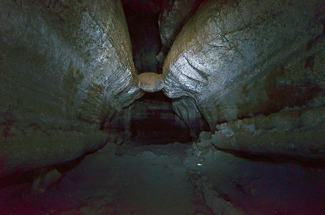
The "Meatball" inside Ape Cave, Mt. St. Helens
Lava stalactites 
Lava "gutter" and tube-within-a-tube
Branching lava tube or side-tunnel
Page with more features and definitions

For the crowdsource exercise, one or more tubes will access ancient lava chambers (this may be more artistic licence then scientifically accurate), where there is the potential to find interconnection over multiple levels, ancient workings and macguffins. An event, such as an earthquake or landslide, may expose a heretofore unknown tube or passageway, or clear a formerly blocked conduit. Now to create a few levels for some populating...
Looks like something out of Giger


Saturday, September 20, 2014

100 posts, or, "I'm just going to keep doing worms."

Zowie, made it to 100 posts, which is approximately 80 more than I expected... Much appreciation to my three loyal readers for getting me this far...

Thanks for reading!

Anyway....

As I proselytized before, nature is apparently ahead of our own imaginations when it comes to the weird and potentially dangerous.  After all, she's got a head start of at least 3 billion years...

Speaking of which, within the Burgess Shale in northwestern Canada is a plethora of Cambrian fossils.  The fine-grained sediments allowed for preservation of the lifeforms occupying the ancestral ocean, many of which have no living relatives.  It was a time at which evolution was experimenting with body forms and functions, and the first segmented and shelled creatures began to roam about.  One of the well-known fossils of the Burgess is the appropriately named Hallucigenia:


A critter so odd that paleontologists are still debating if the spikes went down...


or up...


Hallucigenia was one of the organisms for which no living relative was suspected.  Until now.  Based on a minor detail of its morphology and body parts, the Hallucigenia, or at least a very distant descendant, still roams the earth...

Monday, July 14, 2014

More mines and found dungeons

I like the idea of 'found' dungeons and incorporating accurate geology in dungeons/underground works

Over at io9.com, a pictorial of several historic mines.  Some closed, some still active, most open to tourists.  But they may provide some inspiration and fodder to those great underground temples and passageways for your delving needs...


Of the list, I've been to the Wieliczka Salt Mine, outside of Krakow, Poland.  Although it was first built in the 13th Century, local salt mining extends back to the Iron Age, and was a significant driver in Poland's place as a regional economic power.  Descending into a mine that was active for seven centuries is quite intimidating.


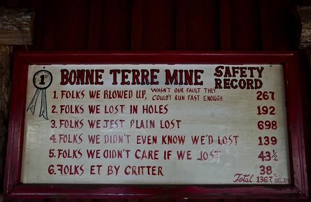
I think this is most parties' henchman tally.